
Proposed New Bedford project could add traffic, preserve green space in Dartmouth

 could be preserved if the business park development goes ahead.")

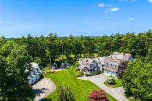
Plans for a new business park on Hathaway Road next to New Bedford’s Whaling City Golf Course could affect Dartmouth residents in a variety of ways, as a city official explained to the town’s Select Board at a meeting Monday night.
Neil Mello, Chief of Staff to New Bedford Mayor Jon Mitchell, emphasized the potential boost to the local economy as he introduced the 100-acre project to the board on Nov. 9.
The proposed park will be targeted to higher-end industries like biotech and medical manufacturing, Mello said, and at capacity could add more than 1,000 new jobs and generate nearly $2.7 million in tax revenues for the city.
But the extra traffic from such a large operation — the park would comprise one million square feet of office and industrial space — could be felt on the Dartmouth side of Hathaway Road, he noted.
Improvements are still in the works for the Hathaway Road-Route 6 intersection — already a source of frustration for many in town.
A $5.6 million state project to form a signalized intersection with Route 6, Hathaway and Tucker roads is still in the 25% design phase, with construction set to begin in spring 2023, according to MassDOT’s project tracker.
“We are aware the town continues to work hard to develop a solution to that intersection,” stated Mello at the meeting.
He added that a forthcoming traffic study for the business park will include the Hathaway-Route 6 intersection, which could help make the improvements a priority for the state.
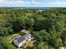
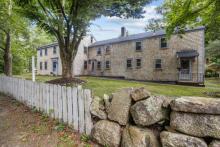
Meanwhile, due to a state law requiring a property of equal size to be protected whenever a protected recreational property is developed, New Bedford has proposed imposing a conservation restriction on city-owned woodlands near Russells Mills village.
Dartmouth Natural Resources Trust has agreed to hold the restriction on 156 acres of a 224-acre property on Woodcock Road.
But because the woods are located behind a rifle range, Mello said, in the interest of safety, the public cannot access the property unless the rifle range is no more.
According to Mello, if and when the range is defunct, there would be the potential to connect trails to the village as well as to town property on Chase Road.
DNRT Executive Director Dexter Mead agreed.
“It’s not just a particularly large block of forest land itself — over 150 acres — but it’s also contiguous with what I calculated to be over 150 acres owned by the Dartmouth Conservation Commission,” he told the Select Board. “Together, it’s a really significant block of forest land and wildlife habitat.”
Mead noted that the state has also recognized the woodlands as a priority habitat for endangered species.
Further, he said, due to its proximity within a quarter mile of DNRT’s Destruction Brook Woods and half a mile of 137 acres owned by the town’s water department, it could form part of a “green belt” or a string of protected land running north of Slocum’s River.
“We think that this part of the project is not only a win for Dartmouth but also for the region in general,” he finished.
Select Board members seemed to cautiously favor the proposal.
Board member David Tatelbaum called it a “really exciting project,” but stressed the need to prioritize the traffic study, calling Hathaway Road and Route 6 “the most dangerous intersection...in the entire area.”
As for preserving the woodland parcel, Select Board chair Frank Gracie III said, “There’s no reason not to do it.”
“This is truly an investment in Dartmouth’s future,” said board member Stanley Mickelson of the conservation project. “It’s a win-win situation for Dartmouth.”