
9 Things to know before doing an archaeology walk

The air smelled of warm dirt and bug spray as we started up the trailhead off of Slade's Corner Road. Twenty-seven people had gathered for the three-to-five-mile truck along Destruction Brook Woods, part of the Dartmouth Natural Resources Trust’s archaeology walk on Saturday.
Most of the group sported heavy hiking boots as they followed professional archaeologist Holly Herbster along the trail. Hikers Joanne Keighley and Mary Whitehead tried identifying bird chirps, while Kara Swallow told me she grew up walking these trails.
The group made a few stops, one to admire the remains of a cellar, another to look at level ground where a house may have been. The properties hidden in the woods belonged to the Russell and the Gidley families, but Herbster had facts that went further than the 1800s. Here are the top nine things you should know before hiking the Destruction Brook Woods.
1. Destruction Brook Woods got its name from rampaging Native Americans.
"I don’t think that’s what really happened," said Herbster, explaining the first of two stories about how the woods were named. According to urban legend, said Herbster, Native Americans would steal cattle from the European settlers, drive them to the river and drown them during King Phillip’s War (1676).
The second explanation is a geological one, she said. "The location is on a fault line—where deep down in the earth’s crust there’s a gap in the rock. It’s on a fault line that moves so that’s where the name comes from."
2. About 100 Native American sites have been recorded in Dartmouth alone.
"Anywhere you want to go in the Dartmouth area, you can expect to find a Native American site," said Herbster. Due to the level ground and freshwater, the area around Russell's Mills was attractive to Native Americans and into the colonial period. The Massachusetts Historical Commission maintains an inventory of all the sites, but the locations aren’t considered public information so that they can be protected, said Herbster.
3. The coastline we see now formed 7,000 years ago.
"Prior to that it was further offshore," said Herbster. "The shoreline would’ve been as many as several miles east and south of where it is today. It’s likely that there’s areas that people were camping or living that are now below the ocean water."
4. "Think of archaeologists as garbage collectors."
Shell middens were used for different purposes by the Native Americans, but they provide a clear look into the past for archaeologists. "If it’s a hole in the ground filled with shells and animal bones and other remains, then it’s a trash pit," said Herbster, who said they’re common along the coastline. "Shellfish, and regular fish too, were a big part of the Native American diet." If it’s a hole lined with shells, then it’s ceremonial.
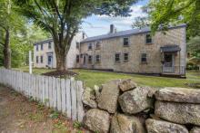
5. The Russell family was living on the property by 1856.
"I don’t have the full background of the property. I’m pretty sure people were living on that property much earlier than that," said Herbster, explaining that she only did a basic search into the property’s history by matching historical maps with census records.
6. The first one to two feet of soil is about 10,000 years of New England history.
"In other places where there hasn’t been as much soil development and plowing, soil doesn’t build up," said Herbster, explaining that a lot of archaeological sites are available on the ground surface in other parts of the country. In New England, however, you usually have to do a bit of digging.
"Typically, what you see is that the topsoil is either black or dark brown," said Herbster. That is the organic material—fallen leaves, dead plants, and rot, she said. The nutrients from the decomposition percolate down, creating an orangish or yellowish subsoil below the topsoil, said Herbster.
7. If you see an apple tree in the middle of the forest....
Herbster said there are some giveaways that she looks for when staking out an archaeological site. If you find fruit trees—apple, pear—in the middle of the forest, that’s a good sign that people have been around (think orchards). Briers and poison ivy plants are also signs that the soil has been disturbed, said Herbster.
8. The Gidley cemetery probably has more bodies than tombstones.
Only five graves are marked in the family cemetery outlined by a stone wall. “That cemetery was definitely built for the family by the family members. I don’t think that anyone would be buried outside those cemetery walls,” said Herbster, who noted that there are probably unmarked graves inside the wall.
However, in New England, it was common to bury people in unmarked graves outside of cemetery confines. “Sometimes if people were paupers, if they were homeless or outcast from society, they didn’t have a family in town; also sometimes African Americans,” said Herbster, explaining who early societies deemed unfit for a marked grave.
9. Don’t touch.
As a professional archaeologist, destroying sites is part of Herbster’s job, but she aims for conservation whenever possible. “When artifacts come out of the ground, they lose 90 percent of their information,” she said. She credited DNRT for maintaining the property. “You can actually see the ruins, but they haven’t been disturbed or altered,” she said.


 Holly Herbster. BY ANGIE HILSMAN")